Download PRJ File
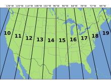
Occasionally you need a .PRJ file to accompany a shapefile. This defines the coordinate system or projection system in use. If you know the projection you need, choose it from this list to get a PRJ file back. Note that this will not convert data projections, it will just give you a PRJ file to accompany your data.

Not sure what you're looking for? Visit the excellent search and reference at spatialreference.org.
Bulk GPX to Shapefile Converter
This converter translates from the GPX format common to GPS units to ESRI Shapefile. The converter includes a GUI (Graphical User Interface) allowing you to select multiple files for batch conversion, or you can pass a single filename to it via command line, useful for use with other tools, scripts, or batch processes.
Bulk KML to Shapefile Converter
This converter translates from Google Earth's KML format (and compressed KMZ format) to ESRI Shapefile, optionally with reprojection. The converter includes a GUI (Graphical User Interface) allowing you to select multiple files for batch conversion, or you can pass a single filename to it via command line, useful for use with other tools, scripts, or batch processes.
Bulk DXF to Google Earth KML Converter
This converter translates from AutoCAD DXF to Google Earth's KML format, including reprojection (source DXF files must have a valid coordinate system of some kind). The converter includes a GUI (Graphical User Interface) allowing you to select multiple files for batch conversion.
Bulk AutoCAD DXF to Shapefile Converter
This tool will allow you to convert one or more AutoCAD DXF files into shapefiles in one pass. Note that this converter does not support DWG, only DXF.
In addition to geometry, the DXF layer names are preserved as an attribute table field. Any custom coloring or thicknesses are also stored as attributes, and any label rotation is saved in the -text.shp attribute table. The desktop version can also handle more complex entities such as LWPOLYLINE bulge values.
The converter includes a GUI (Graphical User Interface) allowing you to select multiple files for batch conversion, or you can pass a single filename to it via command line, useful for use with other tools, scripts, or batch processes. Read more about command line usage...
AutoCAD DXF, ESRI Shapefile / SHP, Google KML / KMZ
This online converter will translate an AutoCAD file (in DXF or DWG formats) to a shapefile or KML format. It can also convert from KML format to shapefile, or KML to DXF, or Shapefile to DXF. Choose the output format you desire and select your input file, then press Convert File.
Note that AutoCAD files must have their coordinate systems in latitude and longitude for conversion to KML to be successful.
GPX (GPS Exchange Format) to Shapefile
GPX is a common export format for GPS data loggers (including mobile phone apps).
CSV to Shapefile / CSV to DXF
This tool will allow you to convert a CSV file to DXF or Shapefile format. The file must have two columns labelled "x" and "y", which contain your coordinates. Note that this conversion handles points only.
Welcome!
Here you will find converters to move between a variety of data formats, including AutoCAD DXF (Drawing Exchange Format), Google Earth and Google Maps KML, ESRI Shapefiles, CSV (Comma-Separated Values), and GPX (GPS Exchange Format).
Most conversions are available online via this site, and select conversion operations are also available as a Windows bulk conversion tool. We also have a handy tool to download coordinate system/projection definition files (PRJ files) for use with existing data.
Please use the menu items to the left to select your conversion and get started!

Subscribe to Remove Limits
A subscription to the converter service will remove the limits for the online converter tools. One subscription covers all types of conversions on the site. Alternatively, the bulk converters accessible via the menu on the left may be an option depending on your needs.
Please try the tool first with the menus on the top left to make sure this will meet your needs. Up to 10 files/day of up to 200MB each may be converted without a subscription.
Annual subscriptions renew automatically every year.
Return here to cancel anytime.
Monthly subscriptions renew automatically every month.
Return here to cancel anytime.
Need to cancel? Enter your e-mail below. We'll cancel your subscription and confirm within 48 hours.
Cancel Subscription
Problem Encountered
We were unable to convert your file!
Please check to make sure the file is of the correct type, and if it's a shapefile, that you have all three component files in a ZIP file.
Need help?
Please send us a note! Please be sure to include your e-mail address if you need a reply.